About Pumori Expedtion
Pumori at 7,161 meter situated in the Khumbu district of Sagarmatha zone at 28 00 53 Latitude and 86 49 41 Longitude which forms the northern boundary barrier between Tibet and Nepal. Pumori is clearly visible from the Tibet side near Rongbuk on the other side of the Rongbuk River.
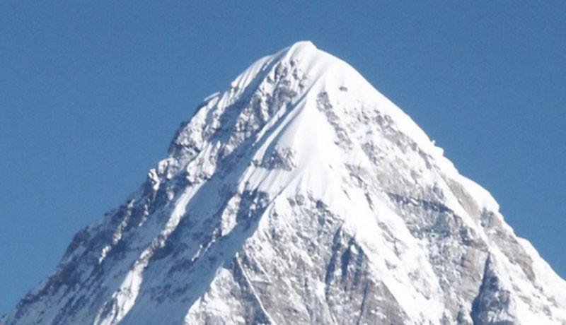
Pumori ExpedtionFrom Nepal it lies on the northern mid eastern Himalayan range very close to Mt. Everest, the walk to the Pumori base camp is almost the same walk to the Everest base camp, till Gorakshep, from Gorakshep the trail branches off towards north very close to the trail of Kalapatthar, the black rock mound hill top at 5,545m very popular with the trekkers for the awesome panorama of the surrounding high peaks and glacier with Everest in just a stone throw distance, Pumori is just few meters away from the top of Kalapatthar. The most accessible and popular normal route is from the side of near Kalapatthar, an expedition to this peak can take weeks, but the late famed Sungdari Sherpa and his Sherpa colleague has climbed this mountain, in less than 8 hours about two decades back. The Pumori base camp from this normal route is based at the foot of near Kalapatthar and on the small glacial pond on the rocky of moraine part of Khumbu glacier.
Climb is done from the south east route to the summit, from this southern face of Pumori, is more ice and rock climbing in some places, the Pumori is mostly covered in a thick blanket of snow right up to the summit. The southern face from Nepal is more like a dome shaped.